 Четиво за Министерството на туризма
В прецизно подбраното от експертите на Българска картографска асоциация (БКА) дарение на библиотеката на ООН „Даг Хамаршелд”, Ню Йорк виждаме солидно присъствие на Община Несебър. Влизането в картографския отдел на библиотеката на ООН има символично значение не само за черноморския град, който е световно културно наследство. Това е глобалния архив на картите на ООН. Българските дипломати и картографи, забелязаха и отстраниха един пропуск в информационното представяне на нашата страна. България от десетилетия не бе попълвала своята колекция от издания и карти в ООН.
Ето с какво и как присъства вече Община Несебър в информационния център на Световната организация. Анотациите са на английски език:
Products from DataMap-Europe Ltd. to UN, New York
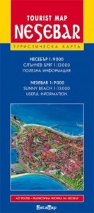
Tourist Map Nesebar 1: 9 000
Description
Publication 2006; Size: 10/21.5 cm fold (60/43 cm unfolded)
Manufacturer: Datamap-Europe Ltd.
Weight: 0.031 Kgs
Realistic pictures of Nessebar. Include: medical centers, post stations, police stations, information centers, parking. Maps of Sunny Beach and Nessebar – road network, petrol and gas stations, tourist, market, sports, culture and entertainments spots, information for hotels.
Maps from Cartographic Studio DavGeo to UN, New York
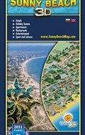
Sunny Beach – 3D panoramic map
Type: 3- dimensional panoramic map
Last edition: 2015г.
Extent: 11,5/24сm (folded); 48/69сm (wrapped)
Language: English – Bulgarian
Description: Panoramic (3- dimensional) tourist map of Sunny Beach resort, created from a real three-dimensional model of the complex.
The new hotel and apartment complexes are updated each year. The new objects are detected by GPS as three-dimensional models are built with accurate coordinates by location.
Ravda / Nessebar – 3D panoramic map
Type: 3- dimensional panoramic map
Last edition: 2013г.
Extent: 11,5/24сm (folded); 48/69сm (wrapped)
English: English – Bulgarian
Description: Panoramic (3- dimensional) tourist map of city of Nessebar (the ancient old town and the new part). Panoramic (3- dimensional) tourist map of village of Ravda. The maps are created from real three-dimensional model of the settlements. Archaeological monuments and sights are reproduced for the ancient Nessebar.
Maps from KartProekt Ltd. and Geopan Ltd. to UN, New York
The Coastal Part of Stara Planina – Kamchia – Tourist Map
Publishers: Ecopan Ltd. and KartProekt Ltd.
Scale: 1:70 000, size: 70/100 cm.
Languages: Russian; English
A detailed tourist map covering the coastal part of the mountain of Stara planina. It includes railway lines and stations, detailed road network with classification, airports, ports, light-houses. The map depicts foot paths, marked trekking routes, tourist chalets and shelters, hotels, camping areas, archaeological sites and other places of interest. It shows a navigable route for water tourism on Kamchia river as well as dangerous rapids and bivouacs. The map presents 28 protected areas including 3 reserves, 18 protected localities, 7 natural landmarks. A map of the firth of Kamchia river (scale 1:10 000) is provided on the reverse.
Последната карта показва Черноморското крайбрежие – от Варна до Несебър и е първата професионална едромащабна туристическа карта на Източна Стара планина – от половин век насам …
Остава да си пожелаем тези съвременни картографски продукти да се предлагат на територията на Община Несебър и българското черноморие. Картата е не само реклама. Тя е най-добрата реклама за съвременния турист, тъй като има доверието му.
Но, това е друга тема ….


